
Finding People Along an Ashland Street
A street-by-street search in Ashland works best as a parcel sequence. First use the county's location form to narrow the street one property at a time. Then capture the account, map and tax lot, and exact site address. JIM confirms the parcel geometry. The recorder and property tools can then supply the document and legal-description trail. A historical directory belongs at the end of the process, after the address has been checked against the parcel rather than assumed from a matching number.
Ownership and document roles are concrete record facts. They are not a declaration that a particular person occupies the site. Keep the search date, property identifier, legal description, and source together. That simple habit makes an Ashland address-research result much easier to review when records from different years point to the same lot.
- Enter the street or house number in the county tax search, choose the applicable roll type and tax year, and review one property result.
- Copy the site address, account, and map or tax-lot number, then locate the same parcel in JIM.
- Use the parcel's legal description and party names to locate the most recent recorded instrument.
- Work backward through earlier grantor and grantee records while confirming the same legal description.
- For an older address question, ask SOHS or JCLS for the relevant directory or reverse-address source and compare it with maps and census material.
Ashland Street Address Search Controls
Jackson County's tax form provides the street-search controls that begin the address trail. It says to use only one search option at a time. For location work, enter a house number if needed and a street name, with street name alone recommended for a broader first pass. The form requires Roll Type and Tax Year for an active search. A location search cannot use the all-years selection.
The county form is an assessment and property tool. It can identify a site, account, owner label, and the roll selected by the user. It does not return a complete street roster. That limitation is why the address, map, and recording steps should remain separate in an address search.
| Field | Format | Practical Ashland use |
|---|---|---|
| Property Owners Name | Optional text | Use surname first; the county advises a last name alone as a strong first try. |
| Location House Number | Optional text | Use with the location method when the number is known. |
| Location Street Name | Optional text | Street name alone is the county's suggested location search. |
| Property Number | Optional text | Search an exact or partial copied county property number. |
| Tax Bill Number | Optional text | Use when the bill identifier is already in hand. |
| Roll Type and Tax Year | Required dropdowns | Select both before search; location mode needs a specific year. |
Note: The form's Reset or Clear Data control removes the entered choice before a different address route is tried.
Ashland Street Maps and Tax Lots
JIM turns a street result into a physical parcel check. The Property map accepts Map and Tax Lot, Site Address, Street Name, and Account Number. Its Layer List controls map data, while hillshade, aerial, topographic, and standard street basemaps give different context. After identifying an Ashland parcel, a user can pan or zoom to adjoining geometry and compare each selected tax lot separately.
Jackson County's weekly tax-lot GIS service describes the public layer used in this map work.
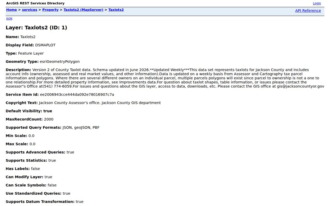
Tax-lot data update weekly. One parcel can have several owners, and an account can be linked to more than one polygon, so the physical geometry must be checked before comparing results along an Ashland street.
Ashland Address Keys for Street Research
Three address keys keep a street directory search accurate. The situs address is the physical location shown in a map or address search. The mailing address is where tax correspondence goes. The legal description is the recorded land identity. A mailing field can differ from the site, and a familiar street number may change over time. Use the tax lot and legal description when moving from a map result to a deed.
City Planning's address-change application shows why this distinction matters in Ashland. The current form connects a new or changed address with a map and tax-lot number, frontage street, site map or diagram, and a development reason. It is a municipal address-assignment record, not a personal directory.
- Parcel
- A county-defined tract associated with map, assessment, and account records.
- Situs address
- The physical site used for a map or address query.
- Plat
- A recorded map that can establish a subdivision, lot, block, or street layout.
- Criss-cross directory
- A reverse-address directory that may organize entries by address rather than surname.
Ashland Deed Layers Along a Street
Jackson County's document trail has useful depth for a carefully researched street. Property Data Online supplies deeds from 2002 forward. The Recording Division's computer index covers official records generated since 1985. For earlier work, the county documents direct and indirect indexes for 1966 through 1979, official-record microfilm through 2001, and historic tax-lot cards covering 1853 through 1999. These layers overlap but do not have identical coverage.
Start with the current grantee or owner label and retrieve the acquisition record. Save the recording date, document number, party roles, and legal description. Then search the prior seller as a grantee, comparing the same legal description at each step. A street-name text search alone can miss parcels that use a different situs convention or a subdivision label.
The State Archives Jackson County inventory documents the modern PDO cutoff and the office-held historical routes. The Clerk's Recording Division counter in Medford is the necessary fallback when an online result ends.
Ashland Address Permits and Assignment
Permits are an address timeline, not a household list. JIM's Permits map uses a point centered on the property or tax lot. After the property is found, click the centered dot and use the black arrows in the pop-up to move through multiple permits. Building permits appear by default; planning permits can be toggled, and the application links to Accela for more detail. County planning-permit points cover 1980 to the present and update weekly.
For city addresses, Ashland Community Development and the City Recorder are the fallback channels for a specific permit, code, or city file. Give the address, map or tax-lot, and date range in a records request. A permit applicant, owner, or contractor identifies a role at a recorded point in time, not a current-person conclusion.
Ashland Planning's current new-address or change-of-address application is another local document route. It requests the map and tax-lot number, existing or parent address, frontage street, owner or applicant details, a site map or diagram, and the development reason. The stated fee is $50.30 per address. That process shows why an Ashland address should be checked against the parcel and development record rather than treated as a fixed personal label.
City Community Development directs users to county property-tax information for maps, aerials, assessed values, improvements, ownership, sales history, permit history, and zoning. For an Ashland street inquiry, that is a useful division of labor: use the county parcel system for property context, JIM for geographic and permit layers, and the City Recorder or city department for a narrowly described municipal file.
Ashland Address Record Coverage
Address-keyed records answer different questions along an Ashland street. The tax roll connects a parcel to assessment and owner data. JIM supplies map geometry and layers. Recorded documents create the legal-description chain. Permits date development activity. A voter-list request follows Oregon rules and does not turn Oregon My Vote into a public street browser. The table separates those uses so a reader can choose the appropriate record rather than overread one result.
| Address record | Keeper | What it can show | Access and limit |
|---|---|---|---|
| Tax and property roll | County Tax Collector and Assessor | Owner label, site and property identifiers, selected roll data | Public owner or location form; not a complete people list |
| JIM tax-lot map | Jackson County GIS | Parcel geometry, site context, account and layer information | Map selection and weekly updates; verify the polygon |
| PDO and recording index | Clerk Recording Division | Document parties and legal-description trail | PDO deeds 2002 forward; office index and microform for older work |
| Planning and building permits | County GIS, Accela, city departments | Property-linked activity and recorded date | Planning points 1980 forward; role and date specific |
| Historical directories | SOHS and JCLS channels | Dated address or household snapshot in a verified volume | Known Ashland fragments only; inspect the actual volume |
The map and parcel tool are owned in depth here. A search centered on one named individual belongs to the Ashland resident lookup workflow instead.
Ashland Voter Data by Street
Oregon My Vote lets an individual check that individual's own registration, update it, and view ballot information after identity verification. It does not offer a public Ashland street search. A requested voter list is the separate route. Under ORS 247.948, permitted public list fields may include specified registration information, while full date of birth, Social Security number, driver-license number, signature, Address Confidentiality Program data, and other protected information are excluded.
Oregon's voter-list request page explains the statewide and smaller-than-statewide electronic request process. It says to allow up to ten business days. Hardcopy, labels, and other non-electronic county subsets go to the appropriate county election official. ORS 247.955 restricts commercial use of elector lists.
A registration field is limited evidence at the time of the record. It does not identify every adult connected with a parcel, and protected records are intentionally absent.
Ashland Historical Address Sources
Southern Oregon Historical Society's Mega Index confirms photocopies of Ashland city directories for 1878, 1881, and 1886-87. A reported 1921 SOHS archival copy is another lead. The verified material does not establish a continuous reverse-directory run, so request the specific volume and inspect its title page, publication year, abbreviation key, address section, and page or column before using it in a street history.
JCLS local-history staff can direct researchers to city directories, telephone books, newspapers, yearbooks, card indexes, and microfilm. Pair a directory entry with the tax lot, deed chronology, census, or Sanborn map. An old printed listing is a dated snapshot, and the street-by-street research becomes stronger when those sources agree.
Ashland and Medford hold JCLS's largest local-history collections. The Medford Local History Index is a physical card file that points to people, places, and events in books, magazines, and newspapers with source and page codes. Four digital microfilm readers at Medford can save an image to a flash drive or email it. Those resources offer an Ashland address fallback when the online tax or recording route stops.
The directory collection itself is treated in depth on the Ashland city directory page, rather than repeated here as a general historical shelf.
Ashland Street Research Privacy Limits
An Ashland street directory cannot expose every private detail connected with a street address. DMV information is protected by the Driver's Privacy Protection Act. Utility and phone customer lists are not general public directories. Oregon's Address Confidentiality Program and voter confidentiality rules intentionally keep protected information out of ordinary access. Sealed court material and public-record exemptions set additional limits.
Use a street record for family history, property curiosity, civic research, or to check a source at its custodian. Do not turn parcel geography, a voter record, or a historic listing into a claim of current occupancy. When a record is missing, ask the controlling office about the lawful public access channel instead of trying to defeat a safety or confidentiality program.
Lawful use. Address and property records may support personal, lawful research. Do not use Ashland street information to stalk, harass, threaten, or harm another person.